
Overview Who Needs This? Excerpts Order Book Pictures Chapters
Answers Reviews Destinations Free Stuff More Contact Us
Kings Canyon National Park
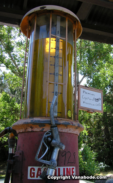
Kings Canyon National Park - hiking, camping and information. Kings Canyon National Park Scenic Byway views are completely opposite of Sequoia National Park's Generals Highway. The highway zigzags down into the canyon between granite walls 8,000 feet high and the rushing white water of the Kings River. At Boyden Cave the South Fork River crosses the highway where you can get out of the car and enjoy the water and amenities. But before all of this make sure you stop by the Kings Canyon Lodge to check out the 1928 gas pumps that are still in operation. Someone from the store will come out and operate the pumps right before your eyes and it is amazing how fast our vehicles can suck down gallons of gasoline. The sign on the pump was 6 gallons for $28.50 - pictures below.
|
|
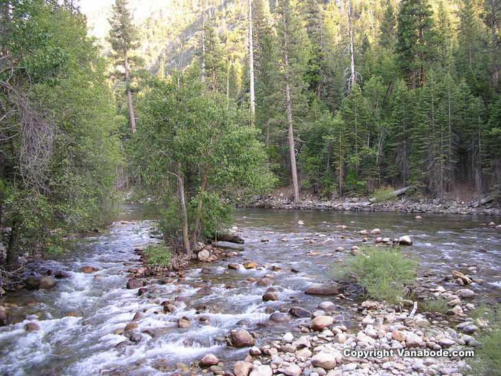
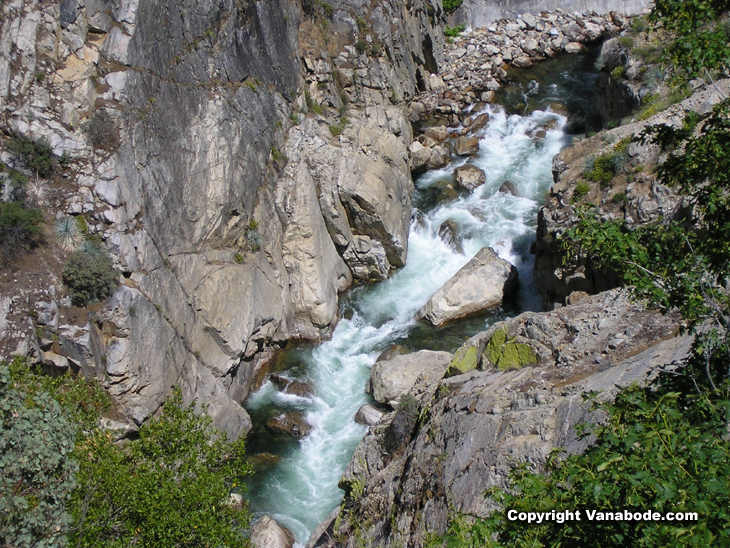
Above: Picture of the 125 mile long Kings Canyon River. The waters are always frigid even during the hot summer months.
There are some terrific views of the Sequoia National Forest from the scenic byway and there are plenty of pull-offs to stop and enjoy the tremendous scenery. I found that in this part of the Kings Canyon National Park you can see some spectacular views just by stopping at each of the pullouts and without hiking too far. Such as the five-minute walk to Roaring River Falls. The trail takes you to a noisy and powerful waterfall rushing through a narrow granite chute. You can opt to walk the trail through the shady oak trees or the paved trail from the main parking lot.
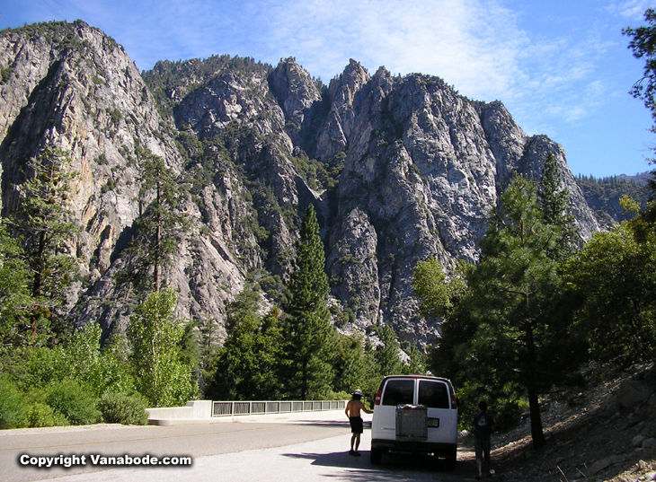
Above: Picture of us parked on the side of the road trying to take in the immense beauty of this national park.
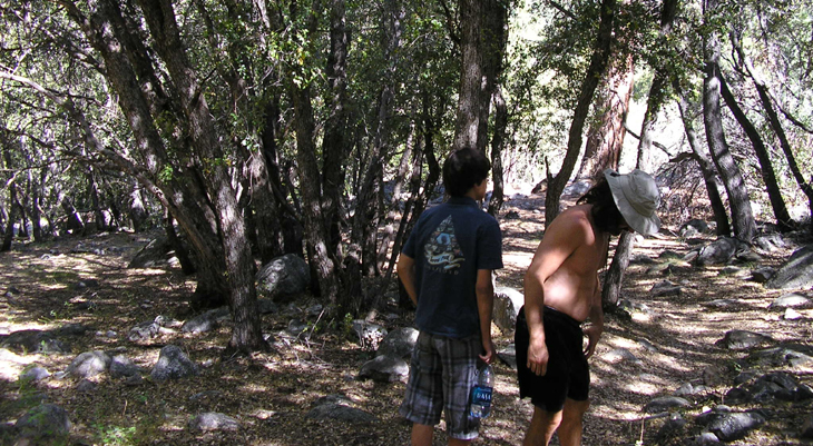
Above: Picture taken walking the oak tree trail on our way to the roaring river falls.
Zumwalt Meadow Trail travels around a lush meadow along the Kings River with the scent of Ponderosa Pine, Sugar Pine, and Incense Cedar. The trail also takes you through fallen granite rocks below the walls of the Grand Sentinel. On the opposite side of the meadow you can see North Dome which rises 8,717 feet in elevation and is said to resemble Yosemite's Half Dome. While hiking around the meadow at the water's edge the mosquitoes were in full force. This was the first time we had encountered any biting insects since being in either Sequoia or Kings Canyon. Obviously it was due to the heat of the day and the moisture of the air around the meadow that stirred up these annoying insects. Once we got away from the water and were hiking amongst the fallen granite rocks there were no bugs. But, as soon as we stepped off the last rock and into the shade of the pines, we were being attacked again. Mosquitoes or no mosquitoes, this was the nicest meadow hike.
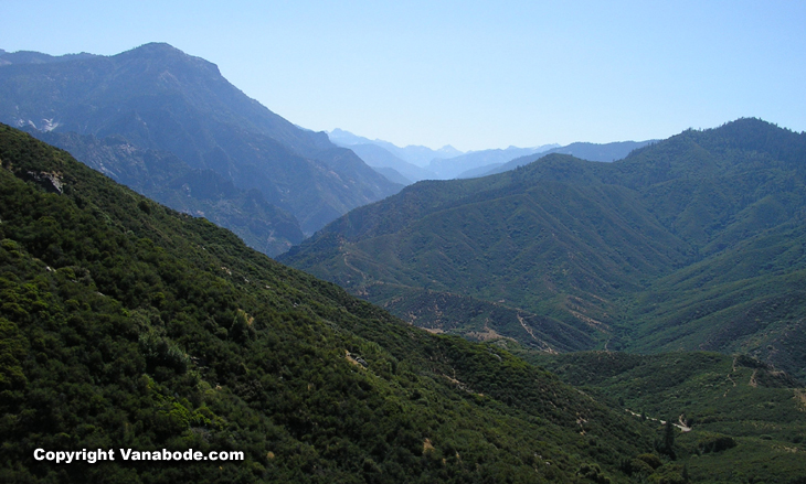
Above: Picture of the Sequoia National Forest. Surrounding the national parks are many national forests and state forests.
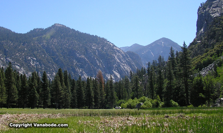
Above: Picture of the very scenic alpine Zumwalt Meadow. Compared to the rock formations and giant sequoias, the meadows are a beautiful contrast in the parks.
Road's End is just what it sounds like. The road ends by just circling you right back around heading west. There is short-term parking for the hike to Muir Rock or the five-hour hike to Mist Falls. As well as a wilderness permit station and long-term parking for back country hikes to the High Sierra Trail, Pacific Crest Trail and John Muir Trail. No matter how long your hike is it is best to keep your car safe by using the bear boxes provided before heading out on the 30 minute hike or a 5+ day hike.
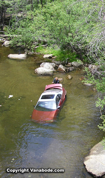
Above: Picture of an antique gasoline tank and an unfortunate driver who ran off the road and into the river.
Jason's thoughts - Great hikes close by but none with many giant Sequoias. Nice ranger talk in the evenings, store is expensive with restaurant at the lodge being more so. Spaghetti and meatballs sold for $12.95 for instance. Showers for $2.50 for ten minutes. This closes earlier than other camps because it is higher up in the more remote area due to snow and lack of interest. Many folks base out of the "Roads End" parking lot for backcountry overnight camping which requires a permit. Some mosquitoes and biting flies in the low lying meadow and stream areas. These canyons and woods are gorgeous and not crowded. They represent an easy place to get away from it all and you can do it cheaply.
Kelly's thoughts - I liked Kings Canyon better than Sequoia. I like the openness of the canyon, the water, and there were still some big trees for shade. As well, the drive was fabulous every mile since leaving the Grant Grove area. I am ready, at least mentally, for some backcountry hiking and camping since being here.
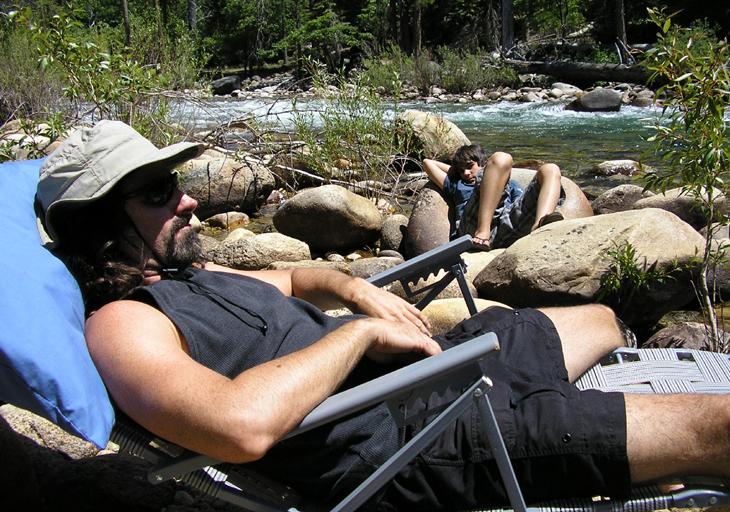
Above: Picture of the boys taking a break from hiking. Lounging next to the gentle rumbling of the river.
Travel Info - The very end of the Kings Canyon Scenic Byway, appropriately named "Roads End". Location of Kings Canyon National Park. Click for more camping and hiking information for Sequoia National Park and Kings Canyon National Park.
American Road Trips - reviews & pictures of places we visited on $20 a day - food, gas and lodging.


Home
Contact Us Copyright
© 2007-2016 Free
Guide They Hate Me
Privacy
Policy Terms
and Conditions Media
Press Affiliate